Enhancing Slope Stability Assessments with Advanced Drone Technology
July 23, 2025
Building solutions
Slope stability assessments are fundamental to ensuring safety, regulatory compliance, and successful project outcomes in engineering, construction, mining, and environmental sectors.
At STA Consulting Engineers, we continuously strive to enhance the quality, precision, and safety of our geotechnical assessments. By integrating cutting-edge drone technology into our slope stability assessments, we now deliver greater accuracy, detailed insights, and safer data collection, even in challenging environments.
Traditional Slope Assessment: Strengths, Limitations
Traditionally, slope stability assessments have relied heavily on manual, ground-level inspections, detailed physical site examinations, and visual analyses performed by engineers and geotechnical experts. While this conventional approach remains crucial, it presents several significant limitations:
Safety risks: Physical inspections in steep, unstable, or remote terrains can be hazardous.
Accessibility constraints: Challenging landscapes often result in incomplete data collection, potentially missing critical risk indicators.
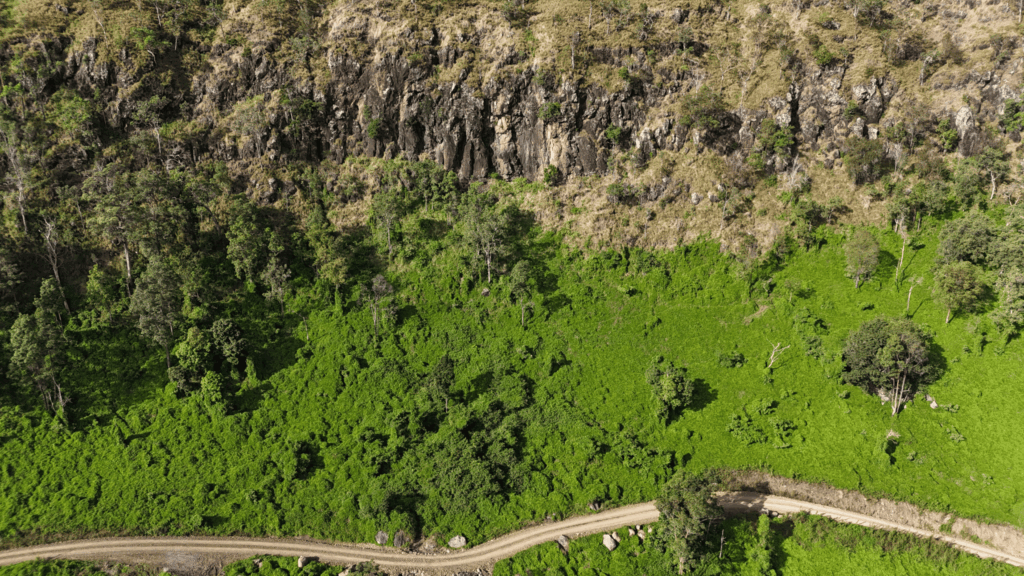
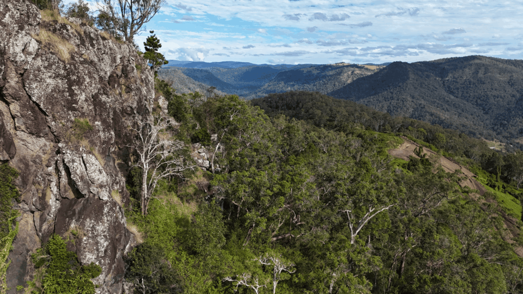
Limited visual data: Ground-level perspectives can overlook subtle terrain changes, erosion, or signs of instability.
Weather dependencies: Harsh conditions often limit or delay manual assessments.
These limitations can compromise decision-making accuracy and introduce unnecessary risks for personnel.
Why STA is Integrating Drone Technology
To address these challenges and significantly enhance our slope stability assessments, STA has adopted advanced drone technology. Drone-assisted assessments complement traditional methods, overcoming their shortcomings while providing additional, valuable benefits:
1. Enhanced Safety for Personnel
Safety is paramount in any geotechnical project. Drone technology allows our experts to remotely assess terrain conditions from a safe distance, significantly reducing the need for physical presence in potentially dangerous environments.
By using drones, we:
Avoid placing personnel in hazardous areas.
Minimise the risks associated with manual inspections.
Provide uninterrupted assessments, even in harsh conditions like extreme heat or wind.
2. Comprehensive and Accurate Data Collection
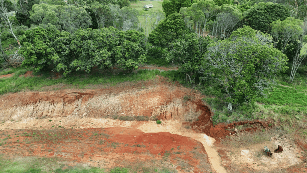
Drones capture extensive, high-resolution imagery and video data, enabling STA Consulting to offer a detailed assessment covering vast and challenging areas efficiently.
Drone-based data collection advantages include:
More extensive coverage of difficult-to-access or expansive sites.
Greater density of data points, facilitating highly accurate terrain modeling.
Early detection of subtle slope changes, erosion signs, and potential instability that might go unnoticed from the ground.
3. Faster, More Efficient Assessments
Speed is often critical for projects that must adhere to strict deadlines or where rapid decision-making is required. Drone technology accelerates the data collection process substantially compared to manual methods, enabling quicker report generation and faster response times for our clients.
This efficiency is particularly valuable for:
Urgent assessments following extreme weather events.
Rapid evaluations required in construction and infrastructure projects.
Repeat monitoring or the need to evaluate a number of adjacent sites, such as in new developments.
4. Detailed Visual Insights and Enhanced Decision-making
Drone footage provides clear, high-definition visuals, granting engineers, project managers, stakeholders, and regulatory bodies unparalleled insights into site conditions.
With detailed drone footage, our clients can:
Visually assess potential risks without direct site visits.
Clearly communicate site conditions to stakeholders.
Facilitate informed, confident decisions based on comprehensive visual data.
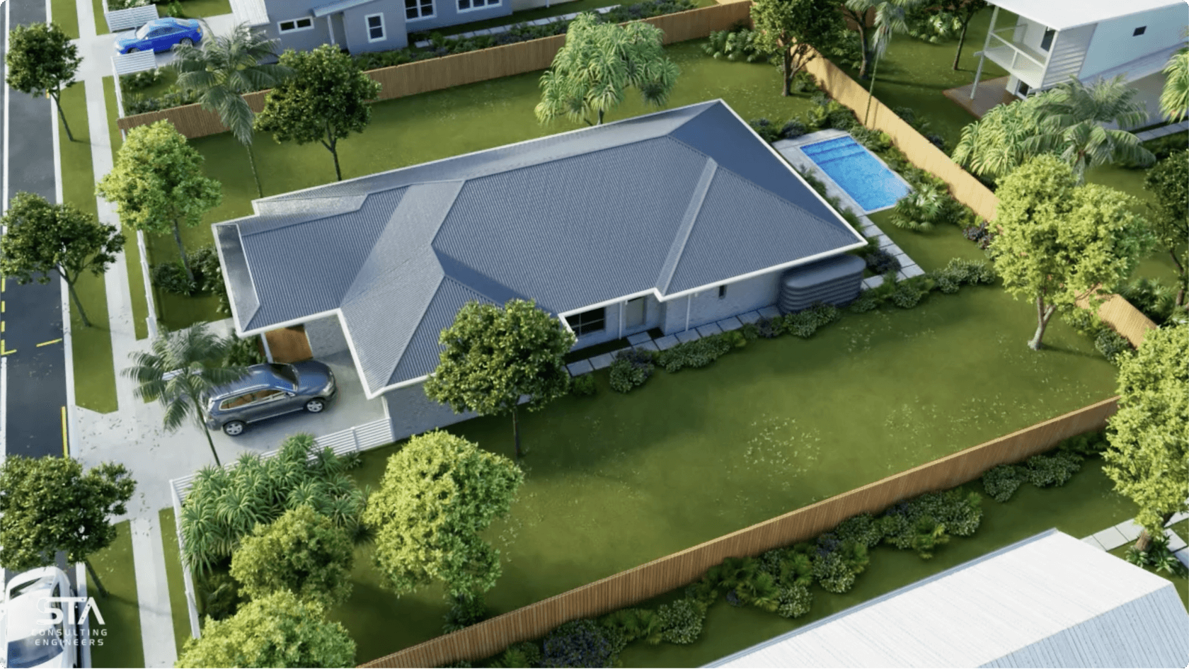
Comprehensive Slope & Stability Reports
STA’s slope stability reports now combine traditional geotechnical expertise with advanced drone technology to deliver comprehensive assessments tailored to specific project requirements.
Each report thoroughly addresses:
Soil composition and geological structure
Slope inclination, stability, and integrity
Indicators of erosion, subsidence, or slippage
Groundwater presence, drainage patterns, and their implications
Impact of vegetation on slope stability
These detailed analyses assist our clients in:
Evaluating land suitability for residential, commercial, or industrial developments.
Identifying and mitigating risks associated with slope instability.
Complying with stringent regulatory and council geotechnical requirements.
Designing targeted and effective slope stabilisation solutions.
Each STA report now includes:
Expert assessment and recommendations.
Visual documentation and detailed condition analysis.
High-resolution aerial drone imagery and video footage.
Precise topographical mapping for clear terrain visualisation.
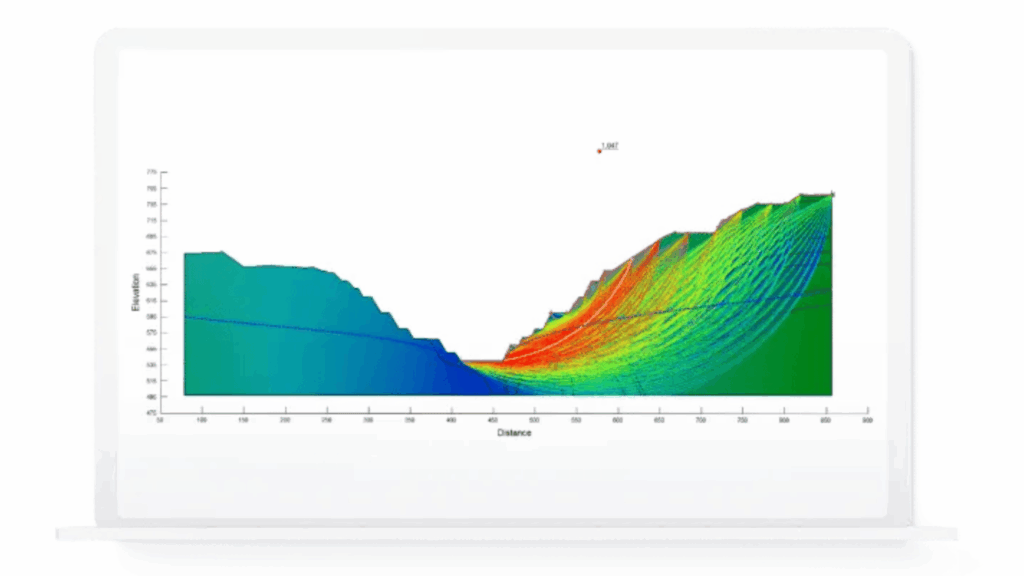
Powered by SLOPE/W: Delivering Advanced Geotechnical Analysis
At STA Consulting, we leverage SLOPE/W, a leading geotechnical analysis tool, to enhance the precision and reliability of our slope stability assessments. This software enables us to model complex soil behaviors and assess various stability scenarios with greater accuracy.
Key Advantages of SLOPE/W Integration:
Accurate Factor of Safety Calculations: SLOPE/W allows us to compute the Factor of Safety under diverse conditions, including wet, dry, seismic, and loaded scenarios, ensuring comprehensive risk evaluations.
Simulation of Soil and Water Interactions: The software facilitates the simulation of layered soil structures and water movement, providing insights into potential seepage and its impact on slope stability.
Assessment of Reinforcement Measures: We can evaluate the effectiveness of various reinforcement strategies, such as anchors, retaining walls, and geogrids, tailoring solutions to specific site conditions.
Enhanced Modeling Accuracy: By moving beyond traditional calculation methods, SLOPE/W enables us to model complex scenarios with higher fidelity, reducing uncertainties in our assessments.
Moreover, the adoption of SLOPE/W aligns with evolving regulatory expectations. An increasing number of local councils now require slope stability analyses utilising advanced modeling tools like SLOPE/W, particularly for developments on steep or high-risk terrains. Our use of this software ensures that our clients’ projects meet these stringent requirements, facilitating smoother approval processes and enhancing overall project safety.
Applications Across Various Industries
The advantages of drone-enhanced slope stability assessments apply to diverse sectors, including:
Construction and Civil Infrastructure: Accurate terrain analysis ensures safe design and cost-effective construction practices.
Improved safety: Minimised personnel risks in challenging terrain.
Precision and accuracy: Robust data capture and analysis.
Rapid turnaround: Timely delivery of comprehensive reports.
Real-time data insights: Remote access to continually updated site data.
Moving Forward with Confidence
STA Consulting remains committed to pushing the boundaries of geotechnical engineering, continuously integrating innovative solutions to benefit our clients. With our drone-enhanced assessments, we deliver safer, more precise, and insightful evaluations, empowering informed decisions for your project’s success.
Ready to experience the difference advanced drone technology can make for your slope stability assessments?
Contact STA Consulting Engineers today to discuss how we can support your project goals with superior accuracy, enhanced safety, and detailed insights.
Friday 15th January 2021 marked the official 30th anniversary for STA Consulting Engineers – and 3 decades of engineering excellence. To remain successful in business...
Following the successful launch of our updated Progress Reports for Design and Soil Testing Services last year, we’re excited to announce a new initiative to...
In 2020, STA released a market-first sanitary drainage design that created a “Safety Zone” inside the slab where articulation is typically not required. We’ve now taken this engineering design approach a step further, making further savings possible.
Get a quick quote for your next project
Send through a few details about what you need and we'll get back to you within 1-2 business days